
Among the state's 35 water trails with 4,500 miles of paddling, the often-overlooked rivers of southeast Minnesota deserve some love.
You can float for miles without spotting any development. There are no real rapids — just the occasional shallow "riffles" to help you along. But these unspoiled oases — all tributaries of the Mississippi — are the closest you'll get to seeing Minnesota the way it looked over a century ago. Along the way you'll discover river villages that seem forgotten in time.
And you don't have to own a canoe or kayak: There are usually one or two rental companies, mom-and-pop operations that offer similar two- to four-hour self-guided paddles. They'll transport you to the launch spot or back from the endpoint. For this north-to-south river guide, I decided to make it complicated by bringing my bike, in search of a combined biking-paddling trip.
The first thing you need to do: Check the river levels. Some smaller rivers respond quickly to a little recent rain. I did most of these trips last spring, but by summer many streams dried up in the drought of 2021.
The DNR is here to help, with an interactive map showing levels all over the state, plus a database of water gauge readings, at dnr.state.mn.us/river_levels. The rivers are measured in either feet or cubic feet per second (cfs). A DNR rating of "Very High" can be hazardous and outfitters will likely be closed. "Low" and — even worse — "Scrapable" ratings can be boring, frustrating and a waste of time.
For most people, "Medium" is ideal for a leisurely day on the river. I like to see levels in the upper end of the medium range, or even borderline "High," to guarantee a smooth ride with a little kick. Unlike this spring's deluge in northern Minnesota, levels in the southeast have been looking good in June 2022.
Outfitters might also report conditions on their websites or Facebook pages. See you on the river — and wear your life jacket.
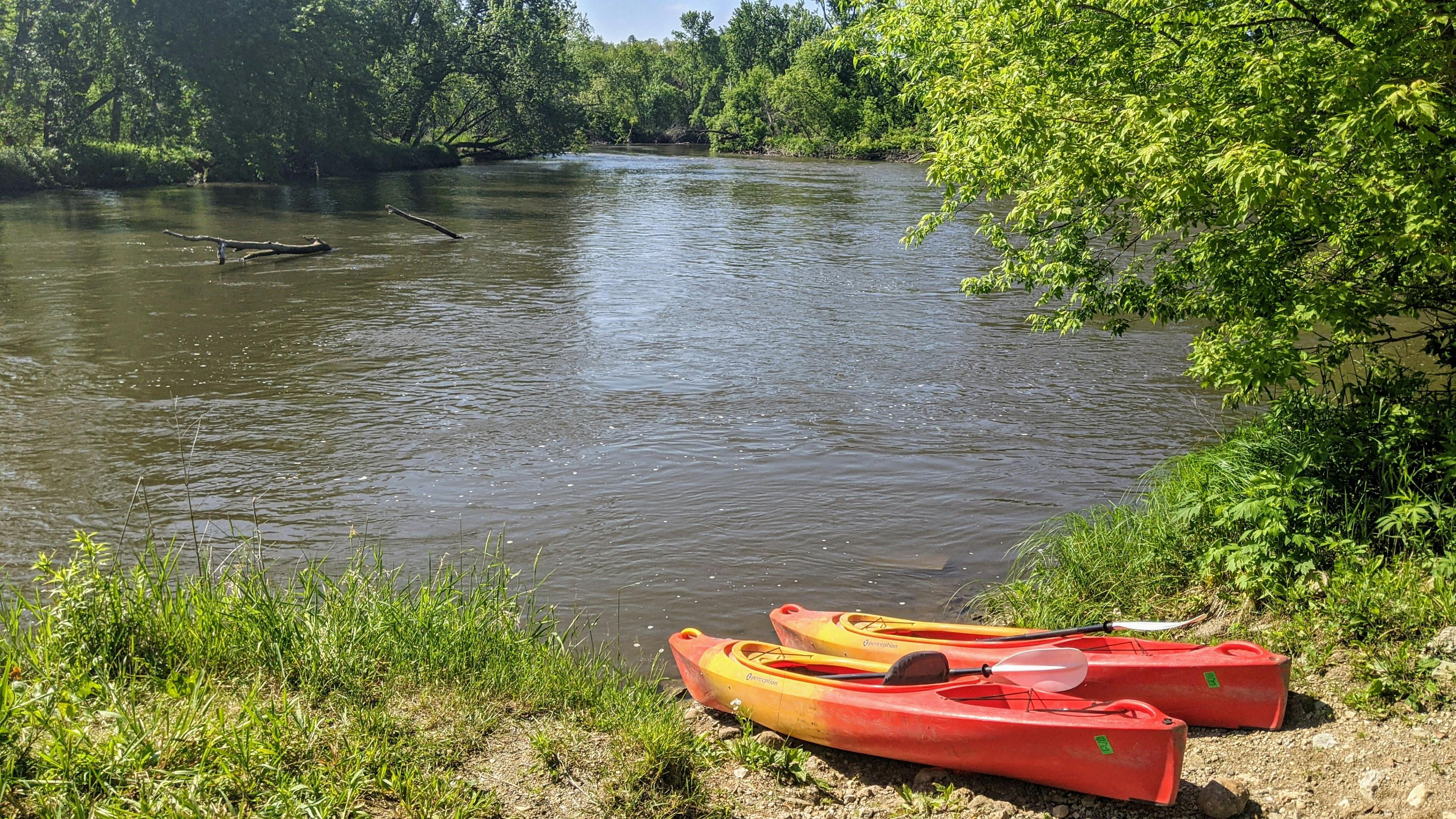
Cannon River (lower)
The route: Cannon Falls to Welch, Minn. (12 miles).
The outfitter: Welch Mill in tiny Welch (kayaks $35-$45, cash only; welchmill.com).
The trip: We checked in at Welch Mill and boarded a shuttle bus to our launch point, 12 miles upstream at Riverside Park in Cannon Falls. The driver pushed our single kayaks off, and we wouldn't see another bridge until we arrived back in Welch about three hours later.
The Cannon has been a designated Minnesota Wild & Scenic River since 1980. At times, it's like you're floating through an avian sanctuary, a cacophony of songbirds flitting overhead.
This stretch of the Cannon is also popular for tubing, so it's often hard to find privacy, or to bypass a logjam of day-drinking drifters. I watched one pneumatic party lose control of a raft carrying their cooler, with a tattooed tuber hilariously belly-flopping across the stream in hot pursuit.
Post-paddle: The excellent, paved Cannon Valley Trail follows the river. So after our paddle we biked 12 miles from Welch to Red Wing, for a hearty dinner at the Staghead gastropub. It was late, so we checked into one of the cookie-cutter hotels along Hwy. 61.
The next morning we pedaled back to Welch and discovered an incredible brunch at the Bleu Dog Cafe, housed in a 19th-century bank, before heading home. It was a good weekend.
Cannon River (upper)
The route: Faribault-ish to Northfield (9 miles).
The outfitter: Farmstead Outdoor Adventures, a new offshoot of the Farmstead bike shops in Minneapolis and Northfield (kayaks $35-$55; farmsteadoutdooradventures.com).
The trip: The Gear ReSource, which sold their kayaking business to Farmstead this year, ran a smooth pandemic operation last year: I booked a time, signed the waiver and did all the coordination online. They directed me to a quiet spot on a country road north of Faribault, where our two kayaks were waiting on the riverbank.
This lesser-known section of the Cannon is narrower and quieter, flowing through the Cannon River Wilderness Area, where a stony cliff towers above the stream. At Dundas, we zipped past the ruins of the 1870 Archibald Mill, next to Farmstead's boathouse. Soon we coasted into the college town of Northfield, landing before we went over the Ames Mill Dam.
Post-paddle: The outfitter would have driven us back to our car, but I decided to bike back via the Mill Towns State Trail to Dundas, for another look at the ruins. Then I bypassed the easy Hwy. 3 shoulder in favor of a misadventure on steep gravel roads to the car. Farmstead Outdoor Adventures now offers combined "bike & boat adventures" of their own from $55.
For lunch, we ordered takeout subs from Hogan Brothers, a mainstay on Division Street in Northfield, and feasted in the town's Riverside Park.
Zumbro River (Middle Fork)
The route: Sail away, sail away, sail away from Oronoco, Minn., to Lake Zumbro (10 miles).
The outfitter: Boulder Dam Canoe & Kayak Rental in Oronoco, north of Rochester (kayaks $25, canoes $40, boulderdamcanoe.com).
The trip: We checked in at Boulder Dam without a reservation, drove to the end point to drop off my car, then got a ride back to the start in the proprietor's personal vehicle. This meant I wouldn't be biking back to my car.
The Middle Fork of the Zumbro has miles of oxbow twists and turns through a woodsy trench that cuts through farmland. We stopped on a shady sandbar, swam across to some micro-caves in a cliffside and took a catnap, while gazing up at a single house on the ridge above.
The river then widened into serpentine Lake Zumbro, with waterskiing families and enviable little lake homes — the Rochester Riviera, if you will. It felt like discovering a secret resort lake in the Alpine foothills. We paddled under the lofty Hwy. 12 bridge and landed on the lakeshore, where my car was waiting.
Post-paddle: Lake Zumbro has two bar & grill establishments — Uncle John's and the Pondy — though neither was taking advantage of their beautiful environs with the outdoor/lakeside seating that we craved on a summertime Saturday evening.
Root River (North Branch)
The route: Moen's Bridge Access to Hwy. 16 Canoe Access, Lanesboro (14 miles).
The outfitter: Root River Outfitters in Lanesboro (kayaks $45-$55, canoes $50-$60, rootriveroutfitters.net).
The trip: Impossibly quaint Lanesboro is built around its historic associations — and now modern recreational connections — to the Root River. During a cozy stay at the old-style Mrs. B's Historic Inn (now Hotel Lanesboro) in June 2019, we booked a Tuesday rental through the outfitter across the street. We were shuttled to our launch at Moen's Bridge upriver, and we pushed off.
The magic of the Root River lies in it winding through the Driftless Area, the four-state region that somehow evaded the glaciers, resulting in an ancient landscape of steep limestone bluffs. The Root flows through probably the most beautiful (and remote) territory in this guide, although distant road and farm machine noise was sometimes heard. Our paddle was just part of the 103-mile Root River State Water Trail.
Post-paddle: Lanesboro is like a museum exhibit of a 19th-century river town, with several small inns, B&Bs and cafes, and it's also at the nexus of the 60-mile Root River State Trail System, which hugs the river and connects several other villages. You could make a long weekend of it: Paddle, pedal, sleep and repeat.
Intermediate bonus trip: Kinnickinnic River in Wisconsin
The route: River Falls, Wis., to Kinnickinnic State Park Bridge (3 hours).
The outfitters: River Guide Kayaks (kayaks $65, two for $120, riverguidekayaks.com); Kinni Creek Lodge and Outfitters (kayaks $55-$65 and up, kinnicreek.com).
The trip: I tried to confine this guide to southeast Minnesota, but the Kinnickinnic on the Wisconsin side is so good, and about a half-hour east of St. Paul. Once you've mastered the Minnesota rivers above, this one is rated for intermediate paddlers, with some Class I, maybe Class II rapids. The first test of your skills: After meeting at Glen Park in River Falls, you're expected to carry your own rental kayaks down a steep trail to the launch.
The narrow, winding Kinni can be a truly wild river, in both senses, with plenty of geology and vegetation on view. Last year, a large downed tree in a fast section required some quick thinking and an improvised portage. If you're looking for something mellower, try Kinni Creek's "Upper Kayak Park" trip. If you want more, there's an "advanced" six-hour paddle to the confluence of the Kinni, St. Croix and Mississippi rivers, ending in Prescott, Wis.
Post-paddle: When in the area, I usually end up at the blues-themed Muddy Waters Bar & Grill in downtown Prescott, for big burgers and New Glarus beers, live boomer blues outside, and high patio views of the St. Croix and Mississippi.


