See
more of the story
See
more of the story
Still Somewhat Active in the Upper Midwest
Areas of rain and snow will wrap up across parts of Minnesota and Wisconsin early Wednesday with drier weather expected in the afternoon. Weather looks a little quieter until Saturday as a potential system moves through the Midwest. At this point, the Saturday system looks to stay mainly south of the Twin Cities, but we'll keep an eye on it as we head through the week.
Status of Spring
"March 20, 2023 - Spring leaf out continues to spread north, arriving several days to weeks earlier than average (the period of 1991-2020) in much of the Southeast, lower Midwest, and mid-Atlantic. PIttsburgh, PA is 17 days early. Parts of SE Colorado and Kansas are days to a week late. The West is a mix of early and late. Southwest UT is days to over a week late and Portland, OR is 2 days late. Spring bloom has also arrived in southern states, days to weeks early in the Southeast, and days to over a week late in the Southwest. Nashville, TN is 25 days early, Las Vegas, NV is 8 days late. How typical is this year's spring? Darker colors represent springs that are unusually early or late in the long-term record. Gray indicates an average spring. Parts of the Southeast, lower Midwest, mid-Atlantic, and New York City area are seeing either the earliest spring leaf on record or a spring that only occurs once every 40 years (dark green). Parts of Arizona are seeing a spring that only occurs this late once every 40 years (purple). Spring bloom is latest on record across parts of the Southwest including California and Arizona, and earliest on record in parts of the upper Southeast including Tennessee, Georgia, South Carolina, and North Carolina."
See more from the National Phenology Network HERE:
"Spring Outlook: California drought cut by half with more relief to come"
"Moderate to major spring flooding predicted along upper Mississippi River from Minneapolis to St. Louis. Significant flooding is ongoing in the western U.S., especially in California, following another series of strong Pacific storms that battered the region and piled on to an already historic snowpack. According to NOAA's U.S. Spring Outlook, the abnormally wet winter will further improve drought across much of the western U.S. as the snowpack melts in the coming months. Winter precipitation, combined with recent storms, wiped out exceptional and extreme drought in California for the first time since 2020, and is expected to further improve drought conditions this spring. NOAA's U.S. Spring Outlook highlights temperature, precipitation, drought and flood predictions for April through June to help the nation prepare for potential weather and climate threats to lives and livelihoods."
8th Snowiest Season at MSP
With more than 81" of snow, the MSP Airport is currently sitting at the 8th snowiest winter on record! We need less than 4" of additional snow to get into the top 5, but would need almost an additional 18" to get to the top spot.
Spring Flood Outlook
"Overall Outlook More Big Changes in the last two weeks... The early March updated outlook for spring flooding in the upper Mississippi, Minnesota, and Chippewa River basins has been upgraded to well above normal, particularly on the Mississippi from St. Paul downstream. The addition of more rain and snow over the past two weeks has raised the amount of water in the snowpack to very high levels for this time of year. Factors that could help alleviate at least some of the snowmelt threat are becoming less relevant the longer the snowpack holds on. And as always, the threat of seeing major flooding will still depend on what kind of rainfall/temperature patterns we get later in March and April. Due to the nature of this year's flood potential, we will issue an additional spring flood outlook on March 23rd, 2023."
See more from the NWS Twin Cities HERE:
Extended Temperature Outlook
The NBM extended temperature outlook for Minneapolis shows milder temps in place over the next several days with a number of 40s possible through the end of the month. Note that there is a potential for a 50F reading in the forecast at the end of the month. Interestingly, the last time we hit 50F or warmer was back on November 26th (53F). Last year, we hit our first 50F on March 15th (51F). On average, we hit our first 50F on March 4th.
Snow Depth
As of Monday, March 20th, the MSP Airport had 5" of snow on the ground. Much of the state of Minnesota and into northern Wisconsin has a pretty significant snowpack. Nearly 2ft to 3ft of snow is on the ground near Lake Superior and more than 3ft on the ground near across parts of the U.P. of Michigan.
Consecutive Days With At Least 1" of Snow Depth
Believe it or not, the MSP Airport has had at least 1" of snow on the ground for 112 consecutive days as of March 21st, which is tied for the 12th longest stretch on record. Warmer days are in the forecast, so we'll see how long this lasts, but we could get into the top 10 here by the end of the week.
Seasonal Snowfall
Many locations are nearly 2ft to 3ft above average snowfall for the season from Sioux Falls to the Twin Cities and north toward Duluth. Prior to this weekend's snowfall, MSP was sitting at 81.2" of snow for the season (since July 1st), which is the 5th snowiest start to any season on record and nearly 36" above average. Duluth has seen 122" of snow this season and the snowiest start to any season on record there and the 6th snowiest season on record.
Twin Cities Weather Outlook For Wednesday
The weather outlook for the Twin Cities on Wednesday, March 22nd shows a lingering light wintry mix possible early in the morning, but we'll stay dry for much of the day. Temperatures will hover in the 30s for much of the daylight ours, which will actually be a little below average for this time of the year.
Weather Outlook on Wednesday
Temps across the region on Wednesday will warm into the 20s and 30s across much of the state with a few lower 40s across far southeastern Minnesota. Temps will generally be around -5F to -15F below average with areas of rain and snow possible early in the day. Drier weather will settle in by midday and through the 2nd half of the day.
Meteograms For Minneapolis
The hourly temps through the day Wednesday will hover in the 30s for much of the day with breezy west to northwesterly winds around 20mph to 25mph, especially during the first half of the day. There could be a few lingering rain/snow showers early, but much of the day will be dry.
Hourly Feels Like Temps
Feels like temps on Wednesday will start in the mid/upper 20s in the morning and will warm to near 30F by the afternoon.
Weather Outlook
Weather conditions will still be fairly active in the Central US through the remainder of the week. Several impulses of energy will move through with a chance of more widely scattered showers and storms in the Southern US, some of which could be strong to severe with locally heavy rainfall.
Severe Threat on Thursday & Friday
Strong to severe thunderstorms will be possible once again in the Southern US later this week with large hail, damaging winds and isolated tornadoes possible.
Extended Temperature Outlook For Minneapolis
Temps will warm into the upper 30s and low/mid through the rest of the week. Note that it'll be nearly -5F to -10F below average through Thursday. As we slide into the weekend, we'll warm into the low/mid 40s, which will be a little closer to average for this time of the year.
Extended Weather Outlook For Minneapolis
There could be a lingering light wintry precipitation in the early morning on Wednesday, but much of the day will be dry. A weak disturbance could bring another light batch of precipitation into far southern Minnesota on Thursday, but most should stay dry. The sun pops out a bit later this week and into the weekend with near average temperatures.
8 to 14 Day Temperature Outlook
According to NOAA's Climate Prediction Center, the 8 to 14 day temperature outlook shows cooler than average temperatures across much of the Western US. and also across the northern tier of the nation. Meanwhile, warmer than average temps will settle in across the Gulf Coast at the end of the month and into early April.
8 to 14 Day Precipitation Outlook
According to NOAA's Climate Prediction Center, the 8 to 14 Day precipitation outlook shows more active weather in place across the Western US and east of the Mississippi River.
Dripping Drainspouts As Minnesota Thaws
By Paul Douglas
Fun fact: snow melts from the bottom up. It's all about albedo: darker soil absorbs the sun's warming rays - melting snow on the ground first. Counterintuitive but true.
Fox9 says March is the 5th consecutive month with 10" or more of snow at MSP. That's the first time this has happened since records began in 1884.
And we are overdue for our first 50F reading at MSP. The average "first-50" is March 4. We haven't been in the 50s since November 26. As we lose snow a higher sun angle will tug at the mercury - we may come close to 50F next week.
Late March and April will bring more rain than snow. Last night was Exhibit A, with wet streets sure to conjure up more putrid potholes as temperatures fluctuate either side of 32F.
A cooler breeze blows today with scrappy clouds. The sun should be more visible Thursday and Friday. A southern storm brushes southeast Minnesota with a few inches of snow Saturday and flurries may reach the metro. Mid to upper 40s a few days next week? My kind of March warm front!
Extended Forecast
WEDNESDAY: Mostly cloudy, breezy. Winds: W 10-20. High: 39.
WEDNESDAY NIGHT: Cloudy with a light rain/snow mix. Winds: N 10. Low: 26.
THURSDAY: More sunshine, pleasant. Winds: N 10-15. High: 38.
FRIDAY: Blue sky, a bit milder. Winds: SE 5-10. Wake-up: 16 High: 42.
SATURDAY: Snow southeastern MN. Metro flakes? Winds: N 10-20. Wake-up: 29. High: 37.
SUNDAY: Plenty of sunshine. Winds: N 5-10. Wake-up: 27. High: 44.
MONDAY: Few sprinkles or flurries possible. Winds: NW 10-15. Wake-up: 30. High: 41.
TUESDAY: Partly sunny and cooler. Winds: NW 7-12. Wake-up: 26. High: 38.
This Day in Weather History
March 22nd
1991: A historic ice storm begins during the afternoon and ends as heavy, wet snow on the 23rd. This event coated the city of Duluth with as much as 6 inches of ice. The 850-foot WIDO TV tower was toppled. 4 million pine trees were damaged or destroyed with the heaviest damage at G.C. Andrews State Forest near Moose Lake in Pine County.
1952: A snowstorm dumps 13.2 inches on the Twin Cities.
Average High/Low for Minneapolis
March 22nd
Average High: 45F (Record: 71F set in 1945)
Average Low: 28F (Record: -14F set in 1888)
Record Rainfall: 1.40" set in 1952
Record Snowfall: 13.7" set in 1952
Sunrise/Sunset Times for Minneapolis
March 22nd
Sunrise: 7:12am
Sunset: 7:27pm
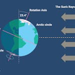
Hours of Daylight: ~12 hours & 15 minutes
Daylight GAINED since yesterday: +3 Minutes & 9 Seconds
Daylight GAINED since Winter Solstice (December 21st): ~ 3 hour & 29 minutes
Moon Phase for March 22nd at Midnight
1.6 Days Since New Moon
National High Temps on Wednesday
Temperatures on Wednesday will be cooler than average from the Southwestern US to the Midwest with readings running nearly -5F to -15F below average. Folks from the Southern US to the Northeast will be nearly +5F to +10F above average
National Weather Outlook Wednesday
The weather outlook for Wednesday looks fairly messy across the nation. There will be areas of rain and snow in the Western US to the Midwest and Great Lakes. With areas of rain and possibly thunder across the West Coast and across parts of the Central US. Note that a few strong thunderstorms maybe possible from near Kansas City, MO to Chicago, IL.
National Weather Outlook
Weather conditions will be fairly active through midweek as a few storm systems move from the Southwestern US to the Midwest with areas of heavy rain and snow. Some of the snow will be enough to shovel and plow with a few strong to severe thunderstorms in the Central US as well.
Extended Precipitation Outlook
According to NOAA's Weather Prediction Center, the extended precipitation outlook shows heavier amounts across parts of the Central & Southern US with localized flooding possible. There will be areas of heavy precipitation in the Western US as well and especially in the high elevations
Snowfall Potential
According to the ECMWF (European model), heavy snow will be found across much of the high elevations in the Western US and across the northern tier of the nation. Some spots in the Midwest could get some plowable snow once again.
Climate Stories
"Humanity can still stop worst consequences of climate change, but time is running out, IPCC warns"
"Humanity still has a chance, close to the last one, to prevent the worst of climate change's future harms, a top United Nations panel of scientists said Monday. But doing so requires quickly slashing carbon pollution and fossil fuel use by nearly two-thirds by 2035, the Intergovernmental Panel on Climate Change said. The United Nations chief said it more bluntly, calling for an end to new fossil fuel exploration and rich countries quitting coal, oil and gas by 2040. "Humanity is on thin ice — and that ice is melting fast," United Nations Secretary-General Antonio Guterres said. "Our world needs climate action on all fronts — everything, everywhere, all at once." Stepping up his pleas for action on fossil fuels, Guterres not only called for "no new coal" but also for eliminating its use in rich countries by 2030 and poor countries by 2040. He urged carbon-free electricity generation in the developed world by 2035, meaning no gas-fired power plants too."
"Underwater turbulence revealed as a key factor in climate change"
"When someone mentions waves, we are most likely to think of the beach and surfers riding breaks to shore, not the waves deep beneath the ocean's surface. Now, new research has shed light on the important role underwater waves play in climate change. Much of the heat and carbon produced by humans is absorbed by the ocean. How much is absorbed depends on underwater turbulence, which can either push heat and carbon down deep or pull it upward toward the surface. It helps to think of the ocean like the layers of a cake, with the colder, denser water at the bottom and the warmer, lighter water on top. Water circulates from warm to cool and back again as if on a conveyer belt. In the North Atlantic, the dense (cold) waters travel southward to the equator, while the lighter (warmer) waters travel in the opposite direction. The Atlantic section of this conveyer belt is called the Atlantic Meridional Overturning Circulation (AMOC) and it plays a key role in regulating global heat and carbon loads. Usually, heat and carbon travel horizontally along one ocean layer that is the same density, but they can also move vertically between layers of different densities. This is how deeper water is brought to the ocean's surface."
"Inside the quest to develop long-range tornado forecasts"
"The newest models are showing tantalizing hints that it might be possible to identify some especially dangerous weather patterns two weeks or more in advance — or even to create full-season severe-weather outlooks. Nearly four decades ago, William Gray, a hurricane researcher at Colorado State University, embarked on the first sustained effort at seasonal hurricane prediction. His initial outlooks each year were issued at the start of the Atlantic hurricane season, which lasts from June 1 to November 30, giving an idea months in advance of how active the full season might end up being. For years, Gray labored alone, relying largely on sea-surface temperatures and on links between hurricane activity in the Atlantic and the El Niño–Southern Oscillation, which drives the periodic warming and cooling of the eastern tropical Pacific known as El Niño and La Niña. There were plenty of both hits and misses. Over time, Gray and protégés Phil Klotzbach and Michael Bell gradually increased the accuracy of their predictions, and others joined the fray."
See more from Yale Climate Connections HERE: