See
more of the story
See
more of the story
Historical Memorial Day Weather
As we observe Memorial Day Monday, here are some past weather stats since 1938 for the Twin Cities (through 1970, Memorial Day was always May 30th - since then, it's the last Monday of May). The warmest high was just a few years ago - back in 2018 - when it reached 100F. The coldest high was back in 1992 when it only reached 49F. Meanwhile, two years ago (2019) we saw 1.83" of rain.
Over the past ten years, you can see both the warmest and wettest Memorial Days stick out like a sore thumb. Surprisingly, we have seen at least a trace of rain each of the past ten years. The coolest high since 2011 was 62F in 2013.
_______________________________________________
Memorial Day Monday Weather Outlook
As we head into Memorial Day 2021 here in the Twin Cities, we should break that streak of rain on the holiday with mainly sunny skies expected all day. Morning temperatures will start off in the low to mid-50s with highs in the afternoon climbing into the mid-70s. Winds will start out of the southwest but become west-northwest in the afternoon at around 5-10 mph.
Looking statewide at your Memorial Day Monday, we'll see highs mainly around average (but up to around 5F degrees above average in northwestern portions of the state). The best chances at seeing a few showers or rumbles of thunder will be in northeastern Minnesota (20% chance), southeastern Minnesota (40%), and over into Wisconsin, otherwise much of the rest of the state should see mainly sunny skies.
A few of the storms over in Wisconsin could be on the strong side, with large hail and damaging winds the main threats.
_______________________________________________
Tuesday Weather Outlook - First Day Of June
Tuesday marks the first day of June and it should be a dry day across much of the state. Mainly sunny skies are expected with highs climbing into the 70s in most locations.
_______________________________________________
Warming Trend This Week - Up Around 90F By Next Weekend
We will see warming temperatures heading through the last day of May into the first few days of June in the Twin Cities. Highs for Tuesday and Wednesday will be in the upper 70s, climbing to the mid-80s by Thursday and nearing 90F by Friday. There will be a slight chance of a few showers Wednesday afternoon and evening, otherwise, it'll be a fairly dry week.
Here's that advertised warmth for the late week/weekend timeframe in the Twin Cities. Mainly sunny skies are expected Friday into the weekend with highs that will be right around 90F. We haven't hit 90F so far this year in the Twin Cities, so if we can get there it'll be at least our first of 2021. Records don't look likely Friday or Sunday, however, the record high Saturday does seem attainable. The record for June 5th is only 92F set back in 1925.
Here's a closer look at highs across the state for next Saturday. With mainly sunny skies and southerly winds, it'll even be up near 90F around the international border. The coolest areas will be along the North Shore, where those southerly winds off the lake will help keep it slightly cooler - but you can even see it is expected to get into the mid-70s in Grand Marais.
_______________________________________________
May Weather So Far (Through Saturday)
Looking back at May so far (through Saturday), despite our wacky up and down temperatures our average temperature has been about a degree above average. Rainfall has been slightly below average, but this doesn't include the rain that fell across the region on Sunday. The good news? No snow was recorded, unlike past Mays - I'm particularly thinking the snowstorms the state saw back in 2019 and 2013.
It's been a whirlwind of a month in the Twin Cities temperatures-wise, with highs ranging from 55F on the 5th to 87F on the 1st (+23 degrees above average) and the 24th. However, the greatest departure from average on the cold side was this past Thursday when the high only mustered to get up to 56F - 17F degrees below average.
There have been a couple of areas of heavier rain so far this month across the state - across southeastern portions and way up in northwestern Minnesota. Some of those areas have recorded above average rain, but all climate locations as of Saturday had below average rain for the month. That includes areas like Park Rapids and Brainerd, which have only recorded 0.24" of rain in each location.
_______________________________________________
Sunshine Will Leave You Feeling Happier
By Paul Douglas
"A light wind swept over the corn, and all nature laughed in the sunshine" wrote English novelist Anne Bronte. Like most people I'm happier on a sunny day. And no wonder. A study out of Australia found that on sunny days people have higher seratonin levels, a brain chemical linked to better moods and feelings of satisfaction and calm. UV radiation, either from the sun or using a tanning bed, may trigger feelings of euphoria, research suggests.
There may be more spring in your step today with enough sunshine for 70s. An instability T-storm can't be ruled out by the dinner hour, especially from the St. Croix River Valley into Wisconsin.
A generally dry week is shaping up with a warming trend. The upcoming weekend should bring 80s, even low 90s, with drippy dew points reaching the oh-zone. I'm ready for a sweaty weekend loitering by the lake.
Today we honor those who sacrificed their lives so that we can live as free people in a free country. The older I get - the less I take for granted. Never forget.
_______________________________________________
Paul's Extended Twin Cities Forecast
MONDAY: Mild sun, late T-storms WI. Wake up 53. High 75. Chance of precipitation 20%. Wind W 8-13 mph.
TUESDAY: Plenty of sunshine. Wake up 54. High 77. Chance of precipitation 10%. Wind S 5-10 mph.
WEDNESDAY: Sticky sunshine, stray T-shower. Wake up 57. High 79. Chance of precipitation 30%. Wind SW 5-10 mph.
THURSDAY: Hazy sunshine, feels like summer. Wake up 60. High 81. Chance of precipitation 20%. Wind SW 8-13 mph.
FRIDAY: Sunny, bordering on hot. Wake up 63. High 86. Chance of precipitation 10%. Wind SW 8-13 mph.
SATURDAY: Sunny, windy - definitely hot. Wake up 67. High 90. Chance of precipitation 10%. Wind SW 15-25 mph.
SUNDAY: Bright sun with a hot wind. Wake up 70. High 91. Chance of precipitation 20%. Wind S 15-30 mph.
_______________________________________________
Minneapolis Weather Almanac And Sun Data
May 31st
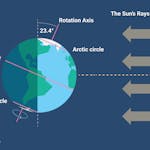
*Length Of Day: 15 hours, 21 minutes and 51 seconds
*Daylight GAINED Since Yesterday: ~1 minutes and 27 seconds
*When Do We Climb To 15.5 Hours Of Daylight? June 7th (15 hours, 30 minutes, and 16 seconds)
*When Is The Earliest Sunrise Of The Year?: June 13-17 (5:25 AM)
*When Is The Sunset At/After 9 PM?: June 12th (9:00 PM)
_______________________________________________
This Day in Weather History
May 31st
1934: Extreme heat impacts the Twin Cities, with highs of 107 in St. Paul and 106 in Minneapolis. Rush City reached 110. Numerous cases of heat ailments affect people and livestock.
1932: A heat wave hits southern Minnesota, with highs of 108 at Campbell, Fairmont, Faribault, and New Ulm.
_______________________________________________
National Weather Forecast
For Memorial Day Monday, we'll be watching a system in the southern United States bringing the chance of showers and thunderstorms from the Four Corners region through the southern and central Plains, along with some snow mixed in for the Colorado Rockies. A cold front in the Great Lakes will bring some storm chances. Meanwhile, an area of low pressure near New England will bring a shower chance to the region.
The heaviest rain from Sunday through Tuesday will fall across portions of the southern Plains where at least 2-4" could fall. We'll also see the potential of over an inch of rain in New England and across portions of Florida.
_______________________________________________
NASA's Curiosity rover spots strange, colorful clouds on Mars
More from LiveScience: "It might look like a postcard from Arizona, but this snapshot shows something much more exotic: the planet Mars, as seen by NASA's Curiosity rover. The image is a combination of 21 individual photographs the rover took recently to study a strange type of wispy cloud over its Gale Crater home. Scientists realized two Earth years ago that the cloud type was forming earlier in the Martian year than they expected. So this Martian year, Curiosity was watching for the early clouds, and it was not disappointed. The clouds did indeed show up beginning in late January, when the robotic skywatcher began documenting the wispy, ice-rich clouds scattering sunlight in sometimes-colorful displays. "I always marvel at the colors that show up: reds and greens and blues and purples," Mark Lemmon, an atmospheric scientist with the Space Science Institute in Colorado, said in a NASA statement. "It's really cool to see something shining with lots of color on Mars.""
Drought saps agricultural economy in Southwest Colorado
More from The Durango Herald: "The grim reality of major irrigation shortages this year in Southwest Colorado is setting in for farmers, water managers and fish habitat. Irrigators tied to McPhee Reservoir contracts will receive just 5% to 10% of their normal supply, said Ken Curtis, general manager for the Dolores Water Conservancy District. The shortages affect full-service users in the water district in Montezuma and Dolores counties, the Ute Mountain Ute Farm and Ranch and the downstream fishery. The water district said no supplemental irrigation supplies will be available to the senior water-rights holders."
Heatwave deaths set to soar as UK summers become hotter
More from The Guardian: "Britain is failing to protect its vulnerable citizens from the threat of intensifying heatwaves, health experts warned last week. Thousands of preventable deaths could be triggered every year because simple measures to keep houses and care homes cool have not been implemented. As global heating worsens and heatwaves become more frequent, the problem is likely to worsen significantly – unless urgent action is taken, they say. Those most likely to suffer include the very young, the elderly and people suffering from chronic conditions such as asthma. Last week, the Met Office revealed there was now a more than 40% chance the annual average global temperature will reach 1.5C above pre-industrial levels at some time in the next five years as greenhouse gas emissions from factories, power plants and cars continue unabated."
_______________________________________________
Thanks for checking in and have a great day! Don't forget to follow me on Twitter (@dkayserwx) and like me on Facebook (Meteorologist D.J. Kayser).
- D.J. Kayser